
Our Platypus are in Crisis
Reporter: Zoe Kean Digital Editor: Carol Rääbus
Designer/DigitalProducer: Teresa Tan
Photographs: Pete Walsh and Teresa Tan
Commissioned by: ABC Hobart x ABC Impact
![]() Photo (above) courtesy of Hobart Rivulet Platypus.
Photo (above) courtesy of Hobart Rivulet Platypus.
Reporter: Zoe Kean Digital Editor: Carol Rääbus
Designer/DigitalProducer: Teresa Tan
Photographs: Pete Walsh and Teresa Tan
Commissioned by: ABC Hobart x ABC Impact
 Photo (above) courtesy of Hobart Rivulet Platypus.
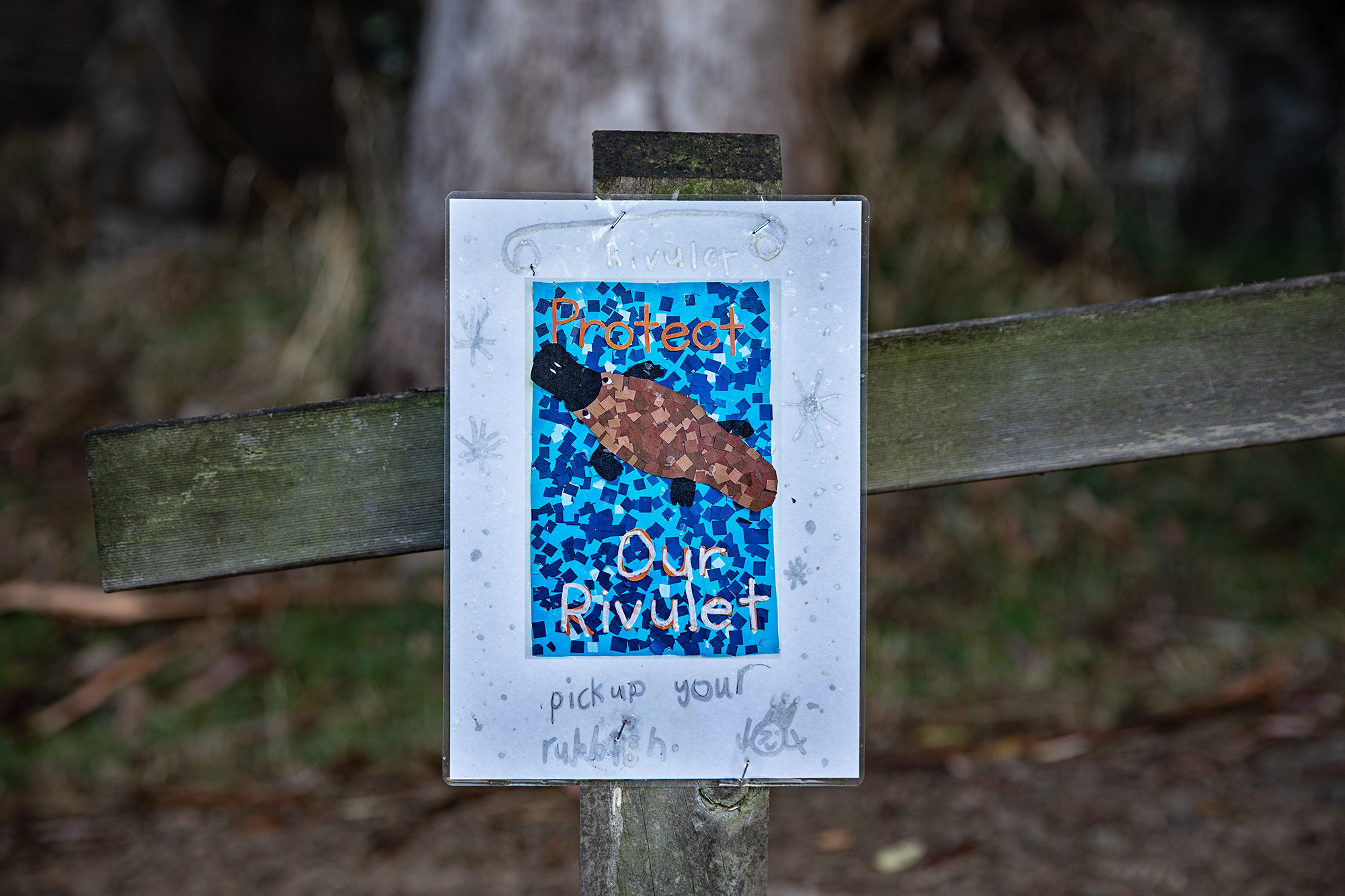 The death of a platypus found in a city suburb may reflect the fate of the entire species if we don't pay closer attention to how this Australian animal is faring, writes Zoe Kean.
Read the full article here.
Design notes
Geography was a big part of how journalist Zoe Kean and I wanted to tell the story of the Hobart Rivulet.
Quite early on I knew that the rivulet would be at the top of the story and that I wanted the interaction to be from the mountains down towards the city as this journey perfectly mirrored Zoe’s introductory words about how the environment clearly degrades as it interacts with humans and our built environment.
My process began with searching the Tasmanian archives for historical maps and reaching out to researchers studying the rivulet, in order to track down historical and contemporary data which inform the visualisation of the rivulet.
![]() Map (above) is from the Tasmanian Archives and Heritage Office: Allport Library & Museum of Fine Art.
Map (above) is from the Tasmanian Archives and Heritage Office: Allport Library & Museum of Fine Art.
I began to think about how I wanted to visualise the Hobart Rivulet, about what story the terrain had to disclose and about what sort of interaction I wanted readers to have. In the early stages of developing this concept I explored a few different approaches, do we show it from a bird’s eye view or just a high angle? Do we visualise the rivulet graphically, through satellite imagery or drone footage? And which of these approaches will be most complimentary to the words and most impactful for the reader?
![]()
The above is a map I created with satellite imagery, annotations, photographs I shot in Hobart, photographs sourced from local activists and colour coded data about the water health of the Hobart Rivulet as it travels down from Mount Wellington (where the environment is relatively unaffected by urbanisation) and winds down and underground through rainwater infrastructure under Hobart CBD and eventually out into the River Derwent. The data about the Hobart Rivulet water health was supplied by freshwater ecologist John Gooderham from National Waterbug Blitz.
Unfortunately the map didn’t make the cut into the final published story as interaction wise it didn’t really work with how the words in the piece flowed.
![]() My tilting drone shot was captured near the top of Mount Wellington looking down towards the River Derwent. It was shot with permission from Wellington Park Management Trust and I shot it with the intention of adding an animated Hobart Rivulet watercourse so that readers could see how landscape changes as we approach the harbour. Unfortunately it did not make cut for the final story as it was ultimately not as impactful or informative as the bird’s eye view satellite imagery of the rivulet.
My tilting drone shot was captured near the top of Mount Wellington looking down towards the River Derwent. It was shot with permission from Wellington Park Management Trust and I shot it with the intention of adding an animated Hobart Rivulet watercourse so that readers could see how landscape changes as we approach the harbour. Unfortunately it did not make cut for the final story as it was ultimately not as impactful or informative as the bird’s eye view satellite imagery of the rivulet.
Geography was a big part of how journalist Zoe Kean and I wanted to tell the story of the Hobart Rivulet.
Quite early on I knew that the rivulet would be at the top of the story and that I wanted the interaction to be from the mountains down towards the city as this journey perfectly mirrored Zoe’s introductory words about how the environment clearly degrades as it interacts with humans and our built environment.
My process began with searching the Tasmanian archives for historical maps and reaching out to researchers studying the rivulet, in order to track down historical and contemporary data which inform the visualisation of the rivulet.
 Map (above) is from the Tasmanian Archives and Heritage Office: Allport Library & Museum of Fine Art.
I began to think about how I wanted to visualise the Hobart Rivulet, about what story the terrain had to disclose and about what sort of interaction I wanted readers to have. In the early stages of developing this concept I explored a few different approaches, do we show it from a bird’s eye view or just a high angle? Do we visualise the rivulet graphically, through satellite imagery or drone footage? And which of these approaches will be most complimentary to the words and most impactful for the reader?
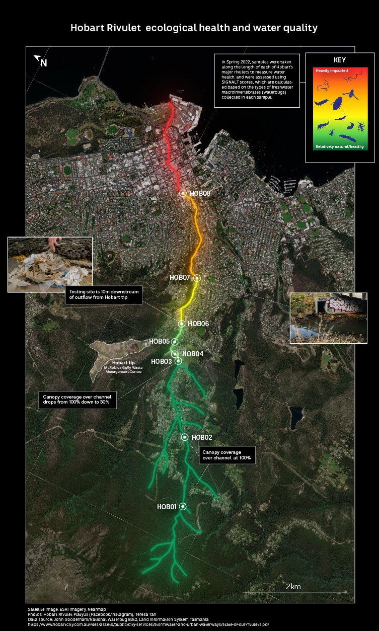
The above is a map I created with satellite imagery, annotations, photographs I shot in Hobart, photographs sourced from local activists and colour coded data about the water health of the Hobart Rivulet as it travels down from Mount Wellington (where the environment is relatively unaffected by urbanisation) and winds down and underground through rainwater infrastructure under Hobart CBD and eventually out into the River Derwent. The data about the Hobart Rivulet water health was supplied by freshwater ecologist John Gooderham from National Waterbug Blitz.
Unfortunately the map didn’t make the cut into the final published story as interaction wise it didn’t really work with how the words in the piece flowed.
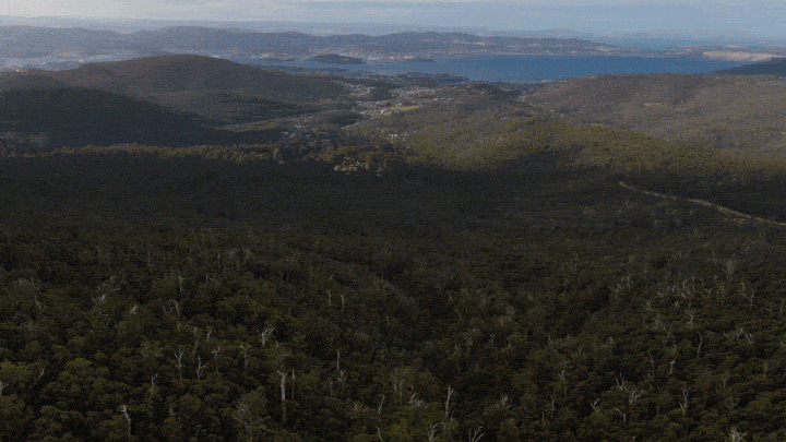 My tilting drone shot was captured near the top of Mount Wellington looking down towards the River Derwent. It was shot with permission from Wellington Park Management Trust and I shot it with the intention of adding an animated Hobart Rivulet watercourse so that readers could see how landscape changes as we approach the harbour. Unfortunately it did not make cut for the final story as it was ultimately not as impactful or informative as the bird’s eye view satellite imagery of the rivulet.

